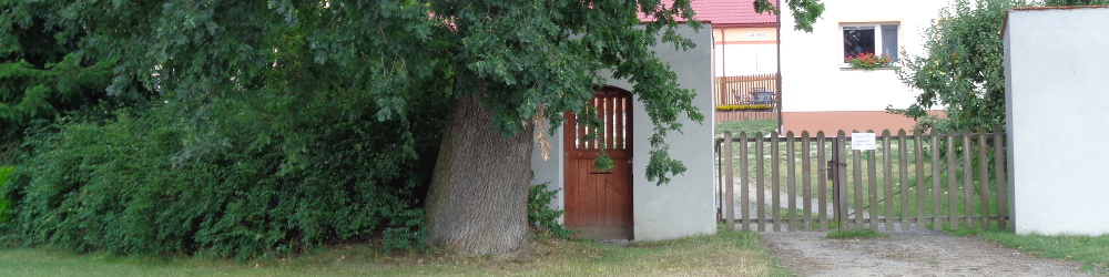
Places of interest nearby
These are places and cities that should definitely not miss your attention:
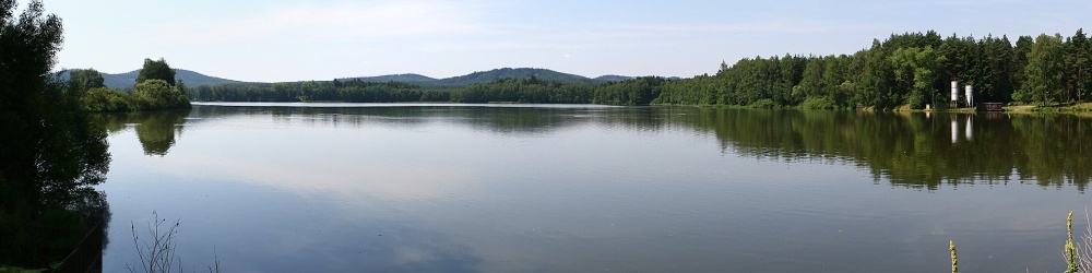
0,5km NW Mezholezský Pond |
Pond located on the northwest edge of the Mezholezy, created by overturning Mezholezský Brook and having an area of 38 hectares, which makes it the 11th largest pond in the Pilsen region and the largest pond in the district of Domažlice. And the original Panský Pond, from which Mezholezský Pond originated, had in 1587 an even remarkable extent of 70 hectares! |
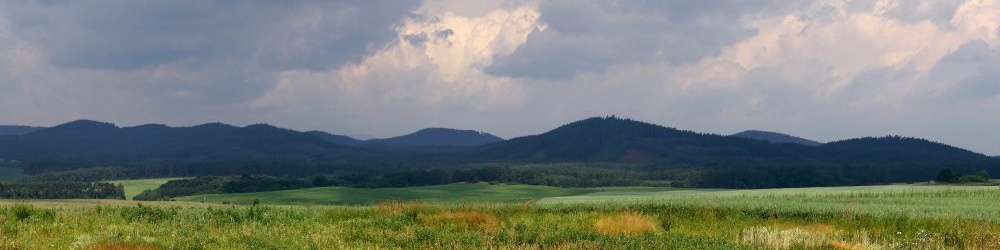
2,5km W to S Sedmihoří - Ručičky (Hands)") |
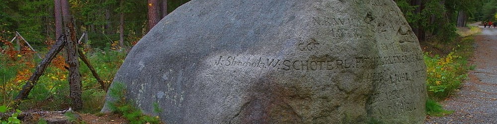
Natural park located in the territory of the same name between Horšovský Týn and Bor u Tachova. The predominantly forested area consists of a depression surrounded by the south, west and northern side of the wreath (although not the name is the answer, because Semihoří = Seven Hills) of eleven horseshoe-shaped peaks with a diameter of 4-5 km, of which the highest are Racovský Hill (619 meters above sea level), Chlum (609 m) and Rozsocha (600 m), which exceed the surrounding landscape by about 180 meters. The four remaining ones, which the park owes its name, are Písečný Hill, Rybniční Hill, Křakovský Hill and Tříslovec. The marginal parts of the park consist of farmland and ponds. The territory of the park is the territory with the best developed forms of weathering of granite in Bohemia. So, what attracts most visitors to the park is the most amazing granite boulders scattered both in the bay and on the hills and peaks of the Sedmihoří. The park passes a 10 km long trail with 12 stops, one of which is a place called "Hands" or "By hands" where there is a huge granite rock with carved two palms facing each other - according to the legend, they were allegedly carved by two peasants as a symbol of reconciliation. |
3km N Telice |
A small village, part of the village Prostiboř in the district of Tachov, first mentioned in 1346. 800 meters north of the village is located Jewish cemetery, the Chapel of Virgin Mary Auxiliary is located in the village. |
4km N Chateau Kopec |
A castle rebuilt into a chateau on a hill near Prostiboř. The epithet mentions it as early as 1235, the next mention is a century later (1333). In 1372, the castle was bought by the Kladruby monastery, which used it to hide its treasures and as a prison, and in 1421 it was conquered by the Hussites. Over time, it changed owners many times, who rebuilt it into a chateau from the 16th century. The dominant large tower was demolished in 1799. The chateau was inhabited until 1950, after which it began to decay and turn into a ruin (it is still without a roof in photographs from 2005). Recently, it has undergone rescue work and partial reconstruction, and at the end of 2021 it changed owners. A green tourist path leads to the castle; from the signpost, continue along the path around the houses to the north for about 200 m. |
7km W Březinka lookout |
A lookout-tower built one kilometer east of the village Bernartice nearby "V březince" Hill at a height of 570 meters above sea level as cell tower with a total height of 48.5 meters and with viewing platform 33.5 meters above the ground, to which you have to climb 178 stairs spiral staircase located in the middle of the mast. There is a beautiful view of the village Stráž, hill with castle ruins Přimda, natural parks Valcha, Sedmihoří and Český les, hill Ebene in Germany with lookout-tower on the top and hill Zvon with the transmitting tower on the top. |
11km W Sycherák |
Recreation center located in wooded landscape of Český les at Chobot pond near the village Stráž. Part of the recreation center consists of private cottages distributed along the banks of the pond in the pine forest, the second part is the autocamp. |
12km S Horšovský Týn |
The town built on the site of a harrow on a merchant trail run by the Horšov settlement, with the first written mention of 1184, with a castle built in the 13th century. From the 14th century it boasts the title of the city. After the great fire in 1547 under the reign of Lobkowitz it was rebuilt in the renaissance style, incl. in the place of the former castle building chateau. Today the third largest city in the Domažlice district is an urban conservation area since 1953, whose main monuments are the Church of St. Peter and Paul at main square, a Capuchin monastery built in baroque style in 1654, St. Anne's Church near the town on the place Na Vršíčku with a tomb of the Trautmannsdorf family and especially the Castle and Chateau Horšovský Týn with a preserved early gothic chapel and an extensive castle park. |
12km N Kladruby u Stříbra |
The town, whose period of greatest glory and prosperity dates back to the early Middleages, thanks to the Benedictine monastery built (as mentioned by Kosmas' chronicle) on the outskirts of the village already in 1115 by Vladislav, which is one of the few Czech kings and princes buried outside Prague, namely in the Kladruby monastery. In 1233 the village was promoted to the town by Václav I, but when the nearby mining settlement Stříbro at the end of the 13th century was also promoted to the town, there occured relocation of business route from Kladruby to through the extraction of silver ore rich Stříbro and the transfer of the attention of the Czech monarchs too. In addition to the monastery, it is possible to visit the chateau park with an original forest with linden and oak forests, a circular educational 6 km long trail with 11 stops, beginning and ending in front of the monastery, or two memorable approximately 450 year old oak trees growing only a few dozen meters from the monastery on the left side of road No.193 to Skapce, which are the rest of the great alley destroyed by a whirlwind in 1843 and which are currently the largest trees in the Tachov region. |
13km NW Bor u Tachova |
The town located on the D5 motorway, which is declared an urban conservation area since 1992. We definitely recommend to visit the pilgrimage Church of St. Nicholas on the square, founded at the beginning of the city and first mentioned in 1282 and a pseudogothic castle standing on the site of a late gothic water castle probably from the middle of the 13th century, from which a white cylindrical tower has survived to this day. |
17km N Stříbro |
The town commemorated for the first time as a mining settlement in 1183. The foundations for the future town were laid in 1240 by Václav I. by the foundation of an early medieval fortification on a steep rock over the Mže river and the Lords of Švamberk with the founding of a minority monastery in 1253. Silver mining subsequently led to the rapid development of the seat, which Přemysl Otakar II. already in 1263 was promoted to the town and granted them considerable privileges, which were confirmed by the other monarchs. For the sightseeing we recommends remnants of town fortifications, burgher houses, renaissance town hall and Marian column on Masaryk square, renaissance bridge tower, the cemetery Church of the Assumption of the Virgin Mary and the Minorite monastery. In 2005 near the Mže river was open mining museum with an outdoor mining exhibition, museum surface 325 meter long mining track and with the possibility of touring the estuary of the Prokop Royal Hedgehog in the length of 700 meters. |
18km W Přimda (castle) |
The ruins of the oldest known stone castle on the territory of the Czech Republic situated above the Přimda town at an altitude of 848 m. This early representative of the romanesque castle architecture was founded in 1121 under the reign of Vladislav I as a guarding post on the Nuremberg route at one of the border crossings to the empire and its ruin is currently protected as a national cultural monument of the Czech Republic. |
20km S Domažlice |
Traditional center of Chodsko area. Originally a market settlement mentioned in 993, in the 60s of the 13th century from the decision of the Czech king Přemysl Otakar II. transformed into a fortified royal town protecting the Regency route with the Chodský Castle as the seat of the royal burgrave, among others managing the surrounding free villages, in which Chods lived - free farmers caretaking the immutable course of the border of the Czech kingdom and safe operation on the aforementioned business Regency route. |